
University of California, Berkeley:
The UC Berkeley Environmental Digital Library

The collections
The collections of the UC Berkeley Environmental Digital Library began as a testbed for research in computer science and information technology; they have since become a valuable repository of environmental and biological information. As of early 1999, the collections represent about a half terabyte of data, including over 70,000 digital images, nearly 300,000 pages of environmental documents, and over a million records in geographical and botanical databases.
All of these data are accessible in online searchable databases. With one exception, where commercially licensed images are used, they are also freely available for the purpose of research and experimentation. For access conditions, see: Disclaimer.
New materials are continually added to the collections. For up-to-date information about the categories of material see: About the Database. For statistics on the numbers of items and sizes, see: Data Statistics.
Content of the collections
The UC Berkeley Environmental Digital Library combines materials from the following sources:
|
Botanical Data
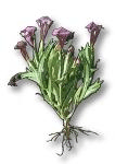
The CalFlora Database contains taxonomical and distribution information for the 8000+ native California plants. The Occurrence Database includes over 300,000 records of California plant sightings from many federal, state, and private sources. The botanical records are linked by scientific name to a collection of photos described below, as well as to distribution maps, photos, and botanical databases at other web sites.

|
Geographical Data
Much of the geographical data in the collection is being used to develop the web-based GIS Viewer. The Street Finder uses 500,000 Tiger records of S.F. Bay Area streets along with the 70,000-record USGS GNIS database. California Dams is a database of information about the 1395 dams under state jurisdiction. An additional 11 GB of geographical data represents maps and imagery that have been processed for inclusion as layers in the GIS Viewer. This includes Digital Ortho Quads and DRG maps for the San Francisco Bay Area.

|
Documents Most of the 300,000 pages of digital documents are environmental reports and plans that were provided by California state agencies. Among the most frequently accessed documents are County General Plans for every California county and a survey of 125 Sacramento Delta fish species. In addition to providing online access to important environmental documents, the document collection is the testbed for Multivalent Document research.
|
|
Photographs
The photo collection includes 17,000 images of California natural resources from the state Department of Water Resources, several hundred aerial photos, 17,000 photos of California native plants from St. Mary's College, the California Academy of Science, and others, a small collection of California animals, and 40,000 Corel stock photos. These images are used within the project for computer vision research.
| | | |
Further information
For general information about the UC Berkeley Digital Library, see the web site: http://elib.cs.berkeley.edu/, or send email to www@elib.cs.berkeley.edu.
Researchers with serious interests in using the testbed, should contact: Ginger Ogle, ginger@cs.berkeley.edu.
[ Testbeds ]
Copyright © 1999 Ginger Ogle


